¡Buenos dias! A partial pass by one of the ASCAT satellites last evening showed the leading edge of the norte was near Mulege, and infrared satellite loops (see nerd note below) early this morning showed low clouds moving rapidly southward near Loreto. All of the most recent model forecasts show the norte reaching us by midday, with winds becoming strong and gusty this afternoon. The norte will subside on Saturday, but the surface pressure gradient will remain relatively tight and with full sunshine expected we will see another windy afternoon. The models are in relatively good agreement that surface high pressure will generally remain in control over the western U.S. over the next week, with ample north background flow in our region. While there will be some day-to-day fluctuations in wind speed, we should see rideable winds through Thursday.
- Today…Mostly sunny. North wind 22-26 mph and gusty.
- Saturday…Sunny. North wind 20-24 mph.
- Sunday…Sunny. North wind 16-20 mph.
- Monday…Mostly sunny. North wind 20-24 mph.
- Tuesday…Mostly sunny. North wind 18-22 mph.
- Wednesday…Sunny. North wind 16-20 mph.
- Thursday…Sunny. North wind 16-20 mph.
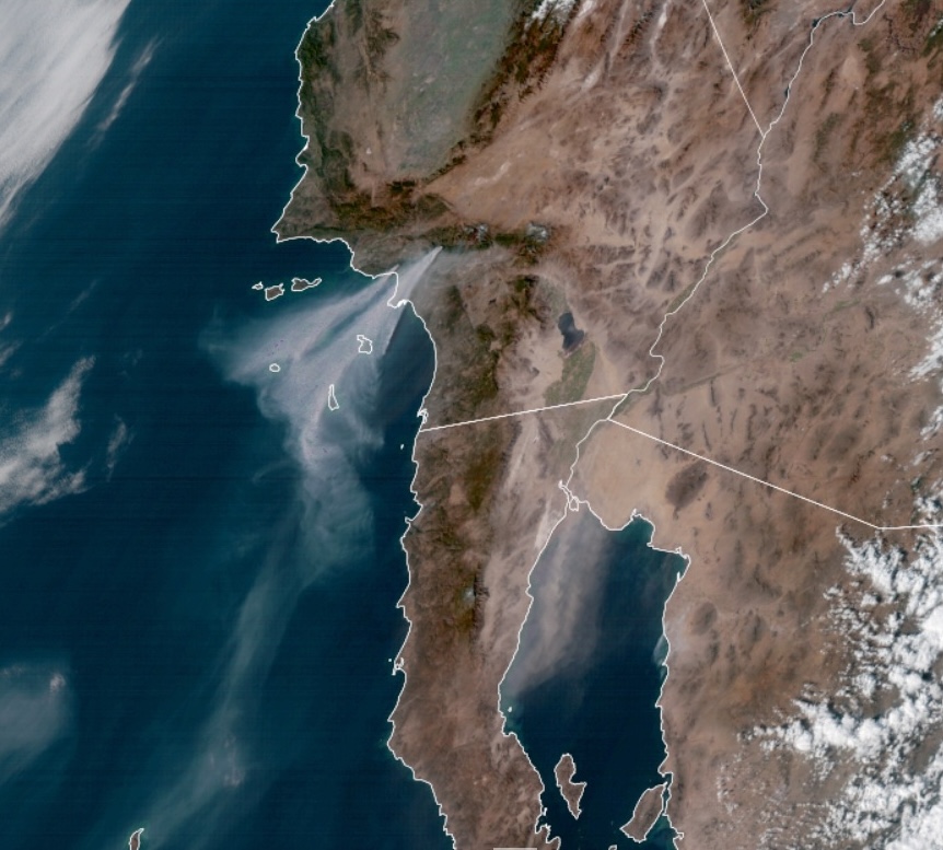
Nerd Note: Weather satellites detect various frequencies of radiation emitted from the earth, and specific frequency ranges are used to help detect things such as clouds, fog, dust, smoke, and even fires. The tragic wildfires in Los Angeles over the past several days have been detected by numerous satellites, and below is an image from yesterday of channel 1 of one of the GOES satellites. This channel which detects radiation of 0.7 micrometers…or less than one millionth of a meter…is used to image smoke and dust. Note the enormous smoke plume from the LA fires. Note also the huge dust cloud over the northeastern Baja Peninsula…this is the leading edge of the norte which will reach us today.
