¡Buenos dias! Sustained winds yesterday (see nerd note below) peaked at around 20 mph, but a couple of satellite passes late last evening measured only light west winds over the Sea of Cortez east of Cerralvo. Today’s forecast is very low confidence, as most of the model forecasts show the background flow will be near or below the threshold that typically will trigger our wind machine. There is a glimmer of hope that we may see a couple of hours of marginal wind during the late afternoon, but chances are slim. Model forecasts are in excellent agreement that strong surface high pressure from the eastern Pacific will build into the interior west of the U.S. on Monday and push a new surge of north wind down the Sea of Cortez. The surface high is then forecast to remain nearly stationary through Thursday, with solid north background flow continuing here. Long-range model forecasts are in good agreement that while the surface high over the western U.S. will break down next Friday, a weak ridge of high pressure will form over the northern Baja Peninsula and give us just enough north flow to help trigger our wind machine through Saturday. The wild card for next week will begin on Wednesday, as models show increasing high clouds over BCS, but at this point it looks like enough filtered sun will make it through to trigger our local thermal each day.
- Today…Sunny. Northeast wind 10-12 mph.
- Monday…Sunny. North wind 20-24 mph.
- Tuesday…Sunny. North wind 20-24 mph.
- Wednesday…Mostly sunny. North wind 16-20 mph.
- Thursday…Mostly sunny. North wind 16-20 mph.
- Friday…Mostly sunny. North wind 16-18 mph.
- Saturday…Mostly sunny. North wind 16-18 mph.
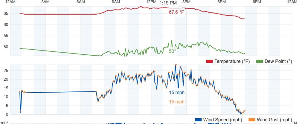
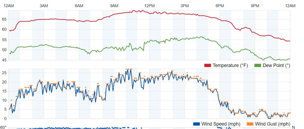
Nerd Note: Sustained winds yesterday peaked at around 20 mph, but graphs from Weather Underground showed a very different day for the northern beaches versus the southern beaches. As a side note…sustained winds from Weather Underground tend to be 3-4 mph high on average as compared to this plot that I use for verification at the campground laventanaweather.com/mbsmart/
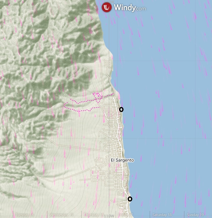
That said, looking at the plots from Rasta Beach (first graph) and the campground (second graph) show a very different day, as the sawtooth pattern at Rasta shows a very gusty, holey day (personally verified!!) while at the campground winds settled into a fairly steady pattern during the afternoon. A wind forecast plot from the HRRR model yesterday may explain why the two sites varied so drastically in wind quality. Note that the wind direction near and just north of Rasta was due north or even had a bit of west in it up towards Punta Gorda, while the winds to the south were more 15 to 20 degrees…NNE… (both directions verified at the respective sites). The north to NNW wind at the northern beaches was likely partially shadowed by nearby bluffs, while the NNE winds at the southern beaches were unobstructed from the bay.


