Wind – March 10, 2025

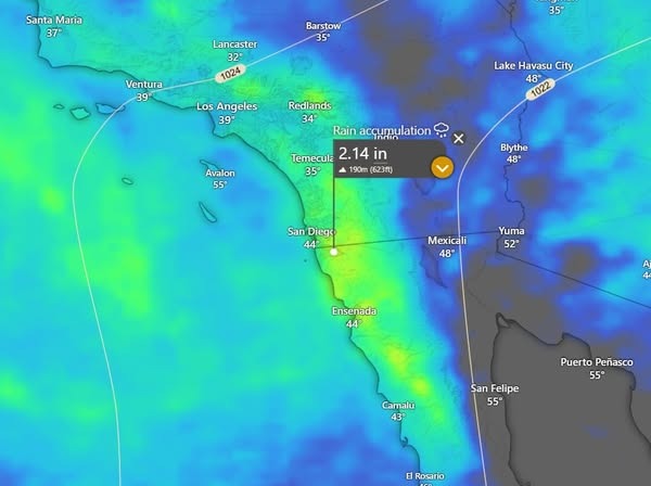
¡Buenos dias! An Oceansat satellite pass around midnight measured NW winds of 10-15 knot just east of Cerralvo, but all of the latest forecast model runs show the background NW flow will weaken substantially today and fall to near or just below the lower threshold to fully activate our local wind machine. It’ll be close, and with full sunshine expected, we may see rideable wind this afternoon especially on the northern beaches. Tuesday still looks like a light onshore day as the surface pressure gradient over BCS remains very weak. Surface high pressure is then forecast to build into the Baja Peninsula from the eastern Pacific on Wednesday, with north flow returning. It now appears that the ridge of high pressure will likely set up just far enough north of us so that north…northwest background flow will continue on Thursday. Models are in good agreement that the ridge will then remain firmly in place Friday through the upcoming weekend, with solid north flow continuing. There may be some thin, high cloud cover on Friday, but otherwise we will see lots of sun and good thermal boosts each day.

  • Today…Sunny. North wind 14-16 mph.
  • Tuesday…Sunny. East wind 8-10 mph.
  • Wednesday…Sunny. North wind 16-20 mph.
  • Thursday…Sunny. North…northwest wind 16-20 mph.
  • Friday…Mostly sunny. North wind 18-22 mph.
  • Saturday…Sunny. North wind 20-24 mph.
  • Sunday…Sunny. North wind 18-22 mph.

Wind – March 9, 2025

Buenos dias! The first day of the norte didn’t have quite the bite that I though it would, as 10 minute sustained winds at the campground yesterday peaked at 22 mph around noon then hovered around 20 mph for the remainder of the day. As predicted by the models the norte peaked overnight, and an evening ASCAT pass measured a large area of 25 knot NNW winds over the Sea of Cortez from just north of La Paz northward to just north of Mulege, with 20 knot winds sampled just east of Cerralvo. Local wind gauges with clear western exposures were measuring occasional NW gusts into the mid 20s early this morning. The latest batch of model forecasts show the norte diminishing this afternoon, but moderate north flow will continue and combine with abundant sunshine to bring us a windy afternoon. Model forecasts are in good agreement that as a surface low approaches southern California on Monday the background flow here will fall to just below the threshold to fully activate our local wind machine. That said it’ll be close, and with full sunshine again expected, we may see a bonus day so best be prepared. Light onshore flow looks likely for Tuesday as the low far to our north moves onshore and the surface pressure gradient over BCS remains weak. Surface high pressure in the eastern Pacific is then forecast to build eastward into the Baja Peninsula on Wednesday and bring a fresh pulse of north flow to the southern Sea of Cortez. Another Pacific storm system will affect California on Thursday and tend to nudge the ridge of high pressure located just to our north southward a bit, and several of the forecast models show our background flow becoming northwest as as result. As the storm system far to our north tracks eastward into the central plains of the U.S. on Friday, surface high pressure from the eastern Pacific is once again forecast to build eastward into BCS with north flow returning and lasting into the weekend.

  • Today…Sunny. North wind 20-24 mph.
  • Monday…Sunny. North wind 14-16 mph.
  • Tuesday…Sunny. East wind 8-10 mph.
  • Wednesday…Sunny. North wind 16-20 mph.
  • Thursday…Mostly sunny. Northwest wind 10-12 mph.
  • Friday…Mostly sunny. North wind 20-24 mph.
  • Saturday…Sunny. North wind 18-22 mph.

Wind – March 8, 2025

¡Buenos dias! Infrared satellite loops early this morning showed patches of low clouds racing from north to south near Cerralvo, and this is likely the leading edge of a new surge of north background flow. Model forecasts are in excellent agreement that surface high pressure centered over the eastern Pacific will move eastward today and another surface high centered over Nevada will build southeastward towards the 4-corners region of the U.S. This squeeze play will create a very tight surface pressure gradient over BCS, with norte conditions developing by this afternoon. The norte is forecast to peak during the early morning hours of Sunday, with norte conditions likely lasting through Sunday afternoon. Monday will be a very different day, as a surface low pressure system approaches southern California causing the background flow here to fall to just below the threshold for fully activating our local wind machine. As the surface low moves inland over far southern California and northern Baja California on Tuesday (see nerd note below), the background flow over BCS will remain weak with only light onshore breezes expected during the afternoon. Models are in good agreement that an east-west oriented ridge of high pressure will then set up just to our north on Wednesday and bring us a return of north background wind. Long-range model forecasts show and active weather pattern continuing to our north, as another storm system impacts California and northern Baja California on Thursday and causes our winds to once again become light. Models show the storm system will then continue eastward on Friday and allow surface high pressure to build back into the Baja Peninsula, with north flow returning.

  • Today…A few morning low clouds, then sunny. North wind 22-26 mph and gusty.
  • Sunday…Sunny. North wind 22-26 mph.
  • Monday…Sunny. North wind 14-16 mph.
  • Tuesday…Sunny. East wind 8-10 mph.
  • Wednesday…Sunny. North wind 16-20 mph.
  • Thursday…Mostly sunny. Northwest wind 10-12 mph.
  • Friday…Mostly sunny. North wind 18-22 mph.

Nerd Note: The next 7 days have the potential to bring some much-needed rain to areas of southern California and the northern Baja Peninsula where severe to extreme drought conditions exist. The first image below shows the forecast accumulated rainfall for the next 7 days, with some areas forecast to receive nearly 2 inches. The second image is a rough composite map showing the most recent drought assessment. Note that much of far southern California and far northern Baja California are in the extreme drought category.

Wind – March 7, 2025

¡Buenos dias! Light and variable winds were detected just east of Cerralvo around midnight by an Oceansat satellite pass, but all of the most recent numerical model forecasts show solid NNW background flow will become established over the southern Sea of Cortez by early this afternoon. Infrared satellite loops early this morning showed the extensive cloud cover we saw yesterday had moved off to the east, and all model forecasts show a sunny day ahead. As a result we will see a substantial thermal which should pull most of the residual west component out of the background flow this afternoon. Forecast models are in good agreement that the surface pressure gradient over BCS will tighten further on Saturday as surface high pressure over the eastern Pacific moves closer, and an area of high pressure builds into the southwestern U.S. The combined effect will likely produce norte conditions here, with typical gusty winds. Models show the norte continuing through Sunday as a ridge of high pressure extends from near the 4-corners region of the U.S. southwestward to just offshore of Ensenada. The latest model runs are in good agreement that the norte will come to an abrupt end Sunday evening as a storm system approaches southern California and the pressure gradient over BCS becomes weak, with only light winds expected on Monday. It now appears that our winds will remain light through Tuesday as the storm system to our north continues to produce light background flow over our region. Long-range model forecasts show Pacific high pressure building back into BCS on Wednesday, with north flow returning and possibly lasting through next Thursday.

  • Today…Sunny. North wind 18-22 mph.
  • Saturday…A few morning low clouds, then sunny. North wind 22-26 mph and gusty.
  • Sunday…Sunny. North wind 22-26 mph.
  • Monday…Sunny. Northeast wind 10-12 mph.
  • Tuesday…Sunny. East wind 8-10 mph.
  • Wednesday…Sunny. North wind 16-20 mph.
  • Thursday…Sunny. North wind 16-20 mph.

Wind – March 6, 2025

¡Buenos dias! Yesterday the wind gauge at the campground (see graph below) measured 10 minute average sustained winds of 18-22 mph from 11:40 am until 3:40 pm, with a peak of 23 mph from 1:10 pm until 1:30 pm. The maximum 10 second average gusts were near 29 mph from around 2-2:30 pm, but I did see instantaneous wind gusts measured into the low 30s. It’s hard to believe that after such a windy day that we will see a down day today, but winds rapidly decreased last evening, and an Oceansat satellite pass around midnight measured west winds of only around 5 knots just east of Cerralvo. The latest numerical model forecasts are in unanimous agreement that we will see only light onshore breezes this afternoon as a storm system moves from west to east over the interior west of the U.S. and our background flow remains light. The overall weather pattern has shifted to a much more active one, with storm systems moving from west to east from the Pacific into the western U.S. about every 3 days or so. This will produce relatively rapid changes in our background flow over the next week, so get ready for a roller coaster ride of wind/no wind days. Friday will likely see a return of solid north background flow as the storm system far to our north moves far enough east to allow Pacific high pressure to build into the Baja Peninsula. A reinforcing shot of high pressure is then forecast to build into the 4-corners area of the U.S. on Saturday into Sunday, bringing norte conditions to our area. Models show the toggle switch will then turn to off on Monday as a storm system approaches southern California and our background flow again becomes light. Long-range model forecasts disagree on timing, but a couple of the more reliable ones show a return of solid north flow as early as Tuesday as surface high pressure builds into our region from the eastern Pacific. Solid north flow is then forecast to continue through at least Wednesday.

  • Today…Partly sunny. East wind 8-10 mph.
  • Friday…Sunny. North wind 18-22 mph.
  • Saturday…Sunny. North wind 22-26 mph and gusty.
  • Sunday…Sunny. North wind 22-26 mph.
  • Monday…Sunny. Northeast wind 10-12 mph.
  • Tuesday…Sunny. North wind 16-20 mph.
  • Wednesday…Sunny. North wind 18-22 mph.

Wind – March 4, 2025

¡Buenos dias! The norte arrived shortly after midnight, and the wind gauge at Rasta Beach recorded wind gusts to around 20 mph. Winds have temporarily diminished early this morning as the cooling downslope winds off the Cacachilas Mountains pushed the strongest winds offshore. As we get surface heating later this morning, the stronger winds offshore will get pulled inland, particularly on the southern beaches. Models show some west component remaining this afternoon along northern beaches, so conditions there will likely be gusty and wind-shadowed. The norte will quickly subside tonight, but solid north background flow and sunny skies on Wednesday will bring us another windy day. The new model runs are in good agreement that strengthening surface low pressure over the interior west of the U.S. on Thursday will bring light westerly background flow to BCS. We also may see substantial high clouds to partially dampen our local thermal, so at this point it looks like a light wind day. Surface high pressure is then forecast to build into the Baja Peninsula from the Eastern Pacific on Friday, with increasing NNW background flow. Models are in excellent agreement that a reinforcing area of high pressure will build into the 4-corners area of the U.S. on Saturday, with norte conditions possible here. Long-range model forecasts show solid north background flow continuing through Sunday, then winds will rapidly diminish as a new storm system approaches California on Monday.

  • Today…A few morning high clouds, then sunny. North wind 22-26 mph and gusty.
  • Wednesday…Sunny. North wind 18-22 mph.
  • Thursday…Partly sunny. Northeast wind 10-12 mph.
  • Friday…Sunny. North wind 16-20 mph.
  • Saturday…Sunny. North wind 22-26 mph and gusty.
  • Sunday…Sunny. North wind 20-24 mph.
  • Monday…Sunny. Northeast wind 10-12 mph.

Wind – March 3, 2025

¡Buenos dias! A couple of satellite passes last night measured NW winds at 10-15 knots, and the latest numerical model forecasts all show winds diminishing this morning, then a new surge of north flow reaching our area later this afternoon. Surface high pressure centered over the eastern Pacific will continue to build into the Baja Peninsula on Tuesday, with norte conditions developing. The norte will subside on Wednesday as the surface pressure gradient weakens, but model forecasts agree that enough north background flow will remain to help give us another windy afternoon. Low pressure is forecast to strengthen over the interior west on Thursday, and as a result we will likely see the background flow become west over BCS, however as the low quickly moves eastward into Colorado by Thursday afternoon, a new surge of north flow may reach us during the afternoon. Pacific high pressure will again build into the Baja Peninsula on Friday, with increasing north flow. Long-range forecasts are in good agreement that surface high pressure will build into the western U.S. on Saturday, bringing another round of norte conditions. The norte should subside on Sunday, but moderate north background flow will likely continue and combine with full sunshine to give us another windy afternoon.

  • Today…A few morning high clouds, then sunny. North wind increasing to 20-24 mph by mid afternoon.
  • Tuesday…Sunny. North wind 22-26 mph and gusty.
  • Wednesday…Mostly sunny. North wind 16-20 mph.
  • Thursday…Mostly sunny. North wind 16-18 mph.
  • Friday…Sunny. North wind 20-24 mph.
  • Saturday…Sunny. North wind 22-26 mph and gusty.
  • Sunday…Sunny. North wind 20-24 mph.

Wind – March 2, 2025

¡Buenos dias! An Oceansat satellite pass around midnight last night showed the leading edge of the next surge of north wind had reached a point just south of Loreto, and local wind gauges detected that increasing north flow began around 3:30 this morning. Model forecasts are in good agreement that surface high pressure centered over the eastern Pacific will maintain a relatively tight surface pressure gradient over BCS over the next several days, with winds likely peaking on Tuesday with norte conditions expected. Some high clouds will stream in from the southwest on Monday and Tuesday, but we should also see plenty of sunshine to give us an added thermal boost. The norte will subside on Wednesday as a storm system moves into California and pushes the axis of the ridge of high pressure over the northern Baja Peninsula southward. Model forecasts are in good agreement that the storm system over the western U.S. will intensify on Thursday and cause our background flow to become more westerly. The break will be brief however, as long-range forecasts are in good agreement that a new surge of north flow will reach BCS on Friday, and as surface high pressure builds to our north on Saturday, norte conditions could again develop.

  • Today…Sunny. North wind 20-24 mph.
  • Monday…Mostly sunny. North wind 20-24 mph.
  • Tuesday…Mostly sunny. North wind 22-26 mph and gusty.
  • Wednesday…Sunny. North wind 18-22 mph.
  • Thursday…Sunny. North wind 12-14 mph.
  • Friday…Sunny. North wind 20-24 mph.
  • Saturday…Sunny. North wind 22-26 mph and gusty.

Wind – March 1, 2025

¡Buenos dias! Wow! Yesterday’s thermal blew my 16-20 mph forecast out of the water, as 10 minute sustained winds at the campground peaked at 24 mph. Satellite passes yesterday around noon measured background wind speeds coming into the channel of only 10 knots, so it was indeed a super thermal! It’ll be interesting to see if we continue to get very strong thermals this spring, as the desert is extremely dry this year and heats up very efficiently as compared to greener years. Model forecasts are all in excellent agreement that today will be a very different day, as surface low pressure over southwestern Arizona creates very light background flow over BCS, with only light onshore breezes expected here. The on/off button will switch back on tomorrow, as model forecasts show a ridge of high pressure building into the Baja Peninsula from the eastern Pacific, with a new surge of north background flow reaching our area. The surface ridge will oscillate north and south a bit over the next week, with winds increasing as it moves north and decreasing as it moves south closer to us. Some thin, high clouds will stream in from time to time this week, but at this point it looks like they shouldn’t be much of a factor. Tuesday looks to be the windiest day, with all of the model forecasts showing a tight surface pressure gradient over BCS, and with sunny skies expected, we could see one of the windiest days of the season. Winds may decrease on Thursday as the ridge moves closer to us and the background flow weakens, but long-range models show more solid north flow on the way again by next Friday.

Today…Mostly sunny. East wind 8-10 mph.
Sunday…Sunny. North wind 20-24 mph.
Monday…Mostly sunny. North wind 18-22 mph.
Tuesday…Sunny. North wind 22-26 mph.
Wednesday…Sunny. North wind 18-22 mph.
Thursday…Mostly sunny. Northeast wind 14-16 mph.
Friday…Sunny. North wind 20-24 mph.

Wind – February 28, 2025

¡Buenos dias! An Oceansat satellite pass last evening measured NW winds of 10 knots over the Sea of Cortez east of Cerralvo, and a new surge of NW flow up to 15 knots had reached to just north of La Paz bay. Infrared satellite loops early this morning showed only a few, thin high clouds in our region, so we should see a significant thermal boost today as well. Model forecasts are in good agreement that an area of low pressure will form over Arizona on Saturday, and this will result in very weak background flow over BCS, with only light onshore breezes expected here. Surface high pressure over the eastern Pacific is then forecast to build back into the Baja Peninsula on Sunday and bring a new surge of north flow into the southern Sea of Cortez. The forecast for Monday is muddy, as model forecasts disagree on exactly where a ridge of high pressure will set up over the Baja Peninsula, but for now it looks likely that we’ll see enough north background flow continuing to give us another windy afternoon. Model forecasts are in good agreement that north flow will increase significantly on Tuesday as high pressure builds into the region from the Pacific. Long-range models show solid north flow will continue through at least Wednesday and possible through Thursday.

  • Today…Mostly sunny. Northeast wind 16-20 mph.
  • Saturday…Partly sunny. East wind 8-10 mph.
  • Sunday…Mostly sunny. North wind 18-22 mph.
  • Monday…Mostly sunny. North wind 16-18 mph.
  • Tuesday…Sunny. North wind 20-24 mph.
  • Wednesday…Sunny. North wind 18-22 mph.
  • Thursday…Mostly sunny. North wind 16-20 mph.