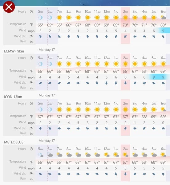
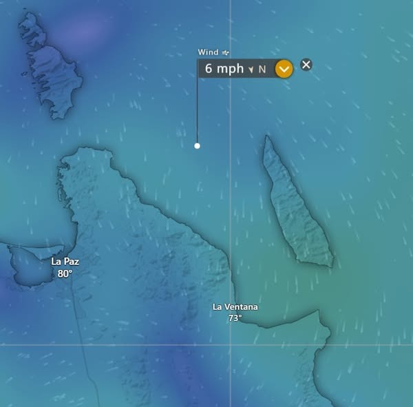
¡Buenos dias! A Haiyang satellite pass early this morning measured SW winds of around 5 knots over the Sea of Cortez just east of Cerralvo, and model forecasts all show light background flow will continue today. Infrared satellite loops early this morning showed some relatively thin, high clouds streaming in from the southwest, but we should see plenty of sunshine as well this afternoon, with a light onshore breeze developing. A narrow ridge of high pressure will move into the southwestern U.S. on Wednesday and send a fresh pulse of north flow down the Sea of Cortez, and with full sunshine forecast to return, we will likely see a windy afternoon. The surface pressure gradient is forecast to weaken on Thursday, and depending on the thickness of high cloud cover, it looks like we could see a marginal day. Models are flip-flopping on the forecast for Friday, with the majority of the latest runs now showing surface high pressure building into the interior west of the U.S. and north background flow increasing over our area. Models are also showing a return of full sunshine on Friday, so at this point it looks like we should see a kiteable day. Long-range models are in good agreement that surface high pressure will remain anchored far to our north from Saturday through Monday, with ample north flow over BCS. The big wild card for Saturday through Monday will be the thickness of high cloud cover, but for now it looks like we will see enough filtered sunshine each day to trigger our local thermal.
- Today…Mostly sunny. East wind 8-10 mph.
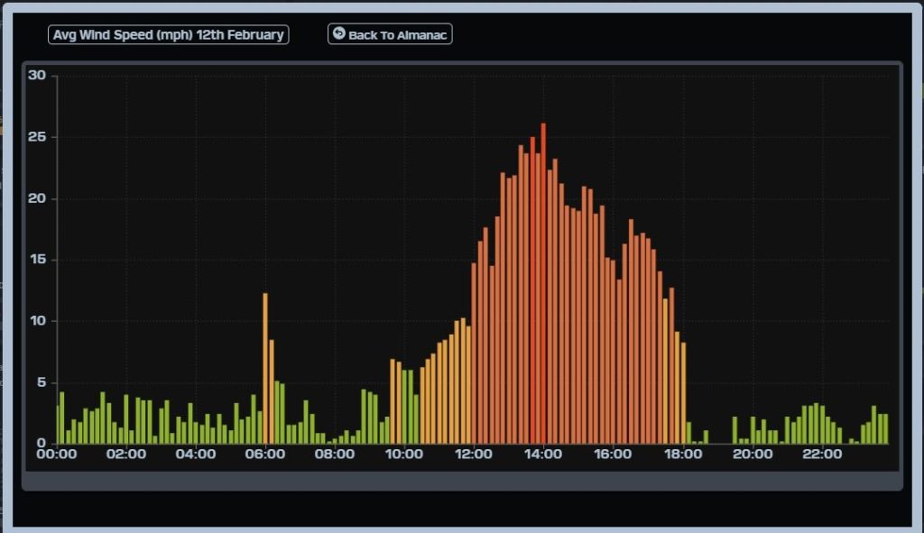
- Wednesday…Sunny. North wind 18-22 mph.
- Thursday…Mostly sunny. North wind 14-16 mph.
- Friday…Sunny. North wind 16-18 mph.
- Saturday…Mostly sunny. North wind 18-22 mph.
- Sunday…Mostly sunny. North wind 16-20 mph.
- Monday…Mostly sunny. North wind 16-18 mph.