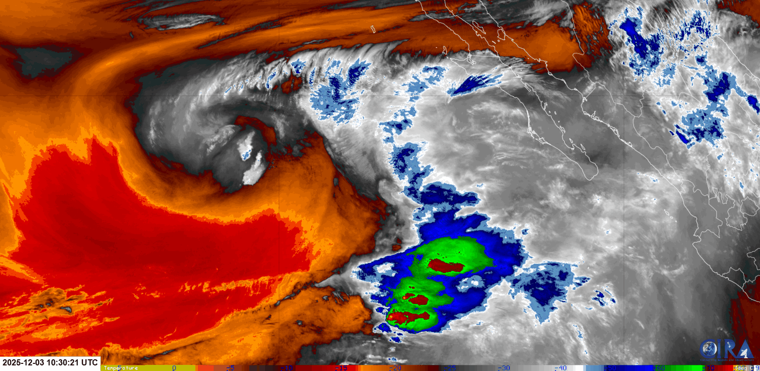
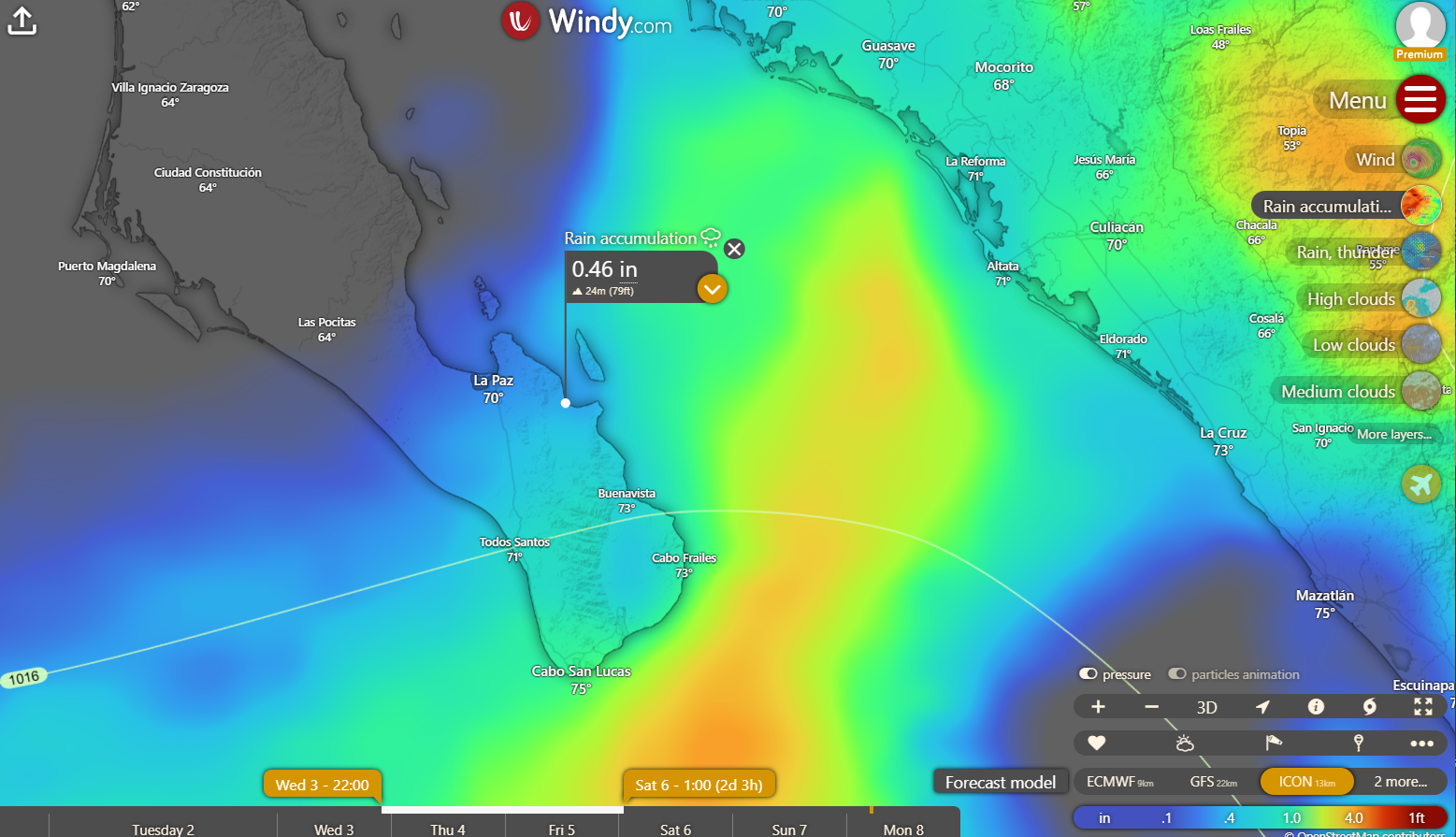
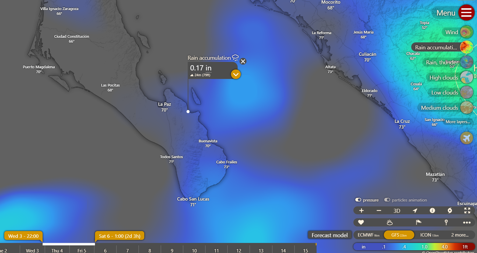
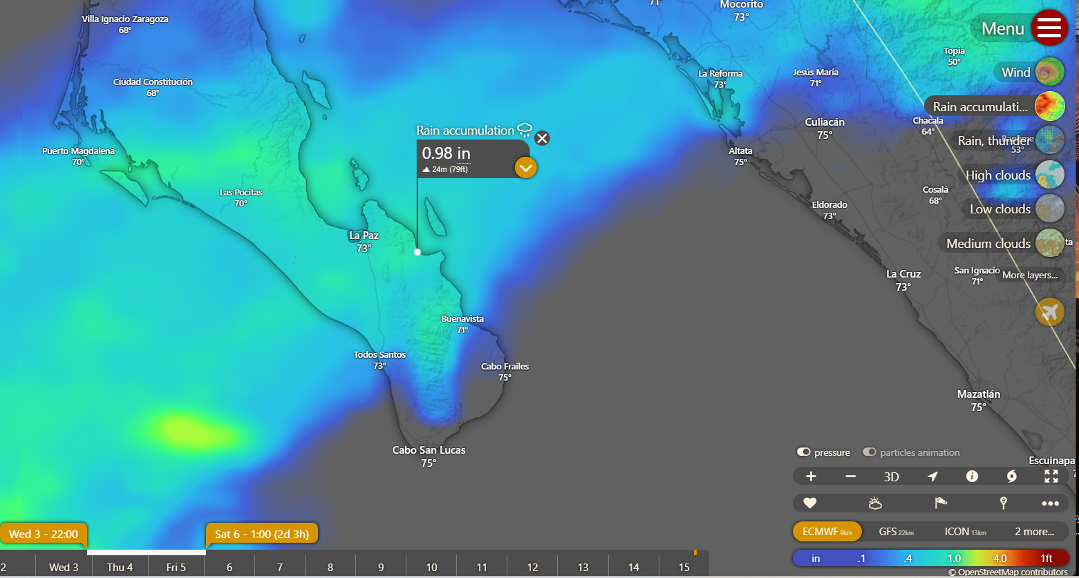
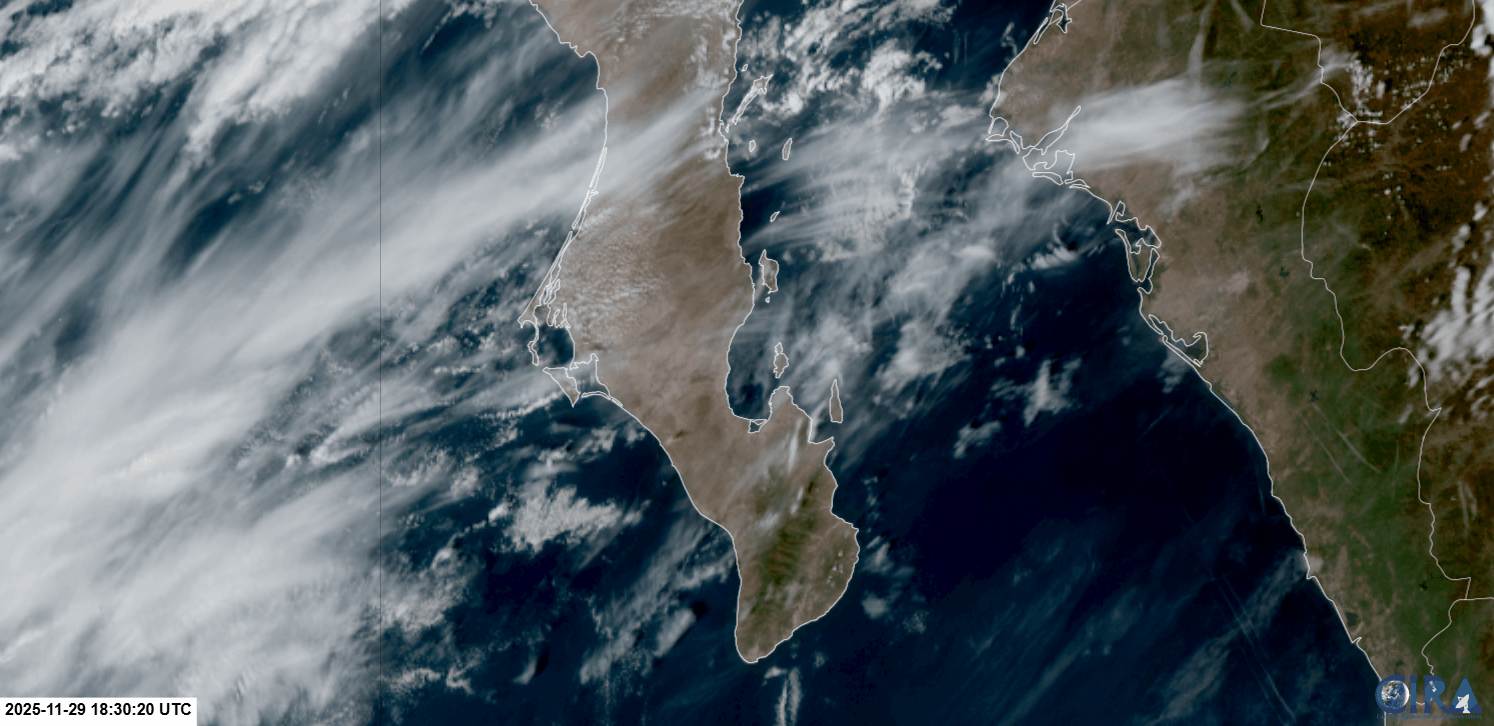
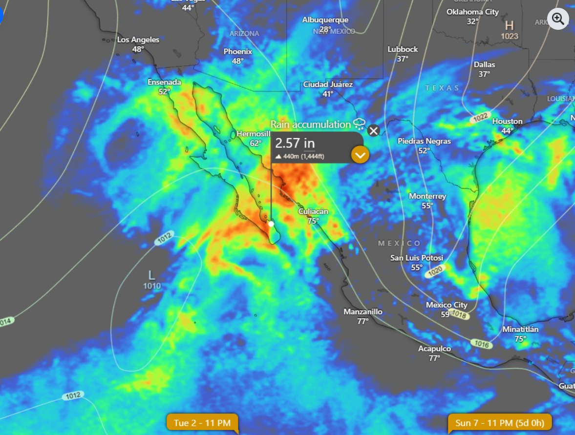
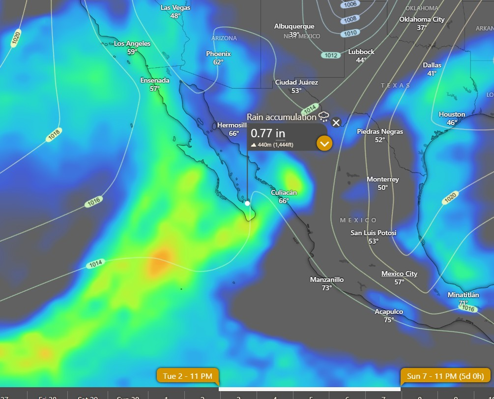
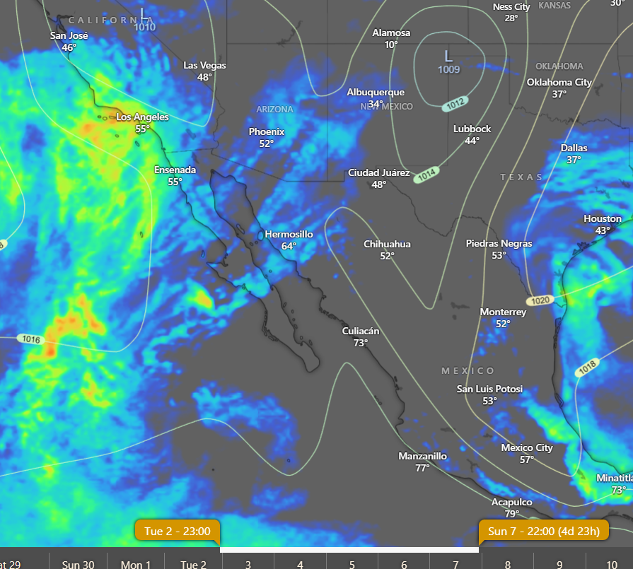
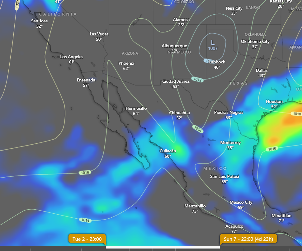
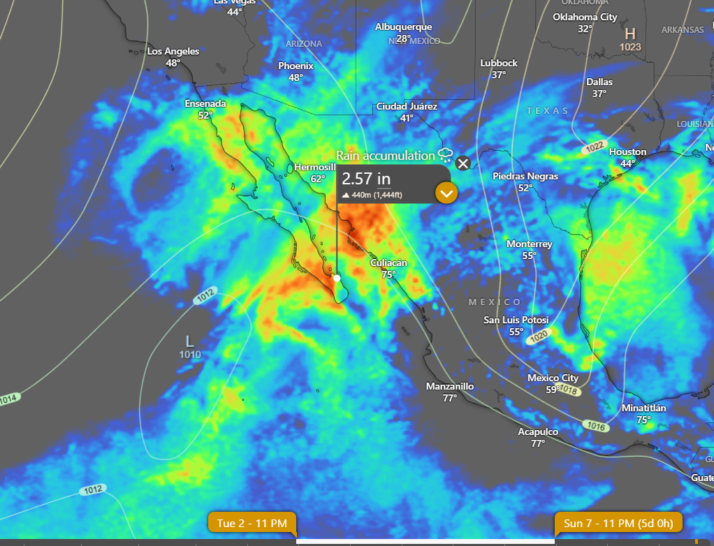
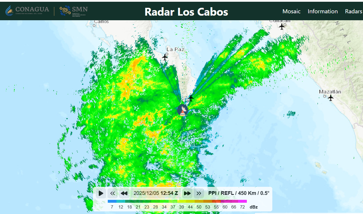
La Ventana Stories

Wind – March 27, 2025

¡Buenos dias! The latest model forecasts show that the overall weather pattern for the next week or so will feature an east-west oriented surface high pressure system over the eastern Pacific and fast-moving storm systems tracking from west to east across the western U.S. As the storm systems move by far to our north, they will tend to nudge the axis of the surface high to the south of BCS, and this will create a pattern of a couple of windy days, then one or two down days. For today, several of the models show just enough north background flow will return to combine with sunny skies to bring us a windy afternoon. Light background flow will return on Friday as the axis of the surface high gets pushed to our south. Saturday looks to be a light wind day as well, then as the ridge of high pressure builds to our north, a new pulse of north wind should arrive on Sunday and peak on Monday. Long-range forecasts disagree on timing, but the general weather pattern would suggest that we’ll see the background flow weaken on Tuesday, then another pulse of north flow should arrive by next Wednesday.

  • Today…Sunny. North wind 16-18 mph.
  • Friday…Sunny. East wind 8-10 mph.
  • Saturday…Sunny. East wind 10-12 mph.
  • Sunday…Sunny. North wind 16-20 mph.
  • Monday…Sunny. North wind 18-22 mph.
  • Tuesday…Sunny. Northeast wind 12-14 mph.
  • Wednesday…Sunny. North wind 16-18 mph.

Wind – March 26, 2025

¡Buenos dias! A satellite pass last evening measured light and variable winds over the southern Sea of Cortez, and all of the latest numerical model forecasts show light background flow will continue today. Thursday will likely see a brief pulse of north flow, as most of the models show the surface pressure gradient tightening slightly over our region. Light background flow is then forecast to return on Friday and last through Saturday, with only light onshore breezes expected each afternoon. Most of the models continue to be in good agreement that surface high pressure centered over the eastern Pacific will build into BCS on Sunday, and with a tightening surface pressure gradient, we should see a windy afternoon. Similar conditions should last through at least Monday, with a couple of the long-range model forecasts showing sufficient north background flow lasting through next Tuesday.

  • Today…Sunny. East wind 8-10 mph.
  • Thursday…Sunny. North wind 16-18 mph.
  • Friday…Sunny. East wind 8-10 mph.
  • Saturday…Sunny. East wind 10-12 mph.
  • Sunday…Sunny. North wind 16-20 mph.
  • Monday…Sunny. North wind 16-20 mph.
  • Tuesday…Sunny. North wind 16-18 mph.

Almost Snake Season

It is almost snake season! Mid March is usually the beginning of the snake breeding season down here and, as the spring comes and the kiters go, they should be coming out more and more! 

The most common snakes to see in March are: 

  1. Baja California Coachwhips: big, fast black snakes seen zooming all over the roads during the heat of the day;
  2. Patch-nosed Snakes: striped tan-colored snakes that also move quite fast;
  3. Cape Gopher Snakes: some of the most beautiful and largest snakes in our area; &
  4. Sand Snakes: little banded or brown shovel-nosed snakes found swimming through the sand. 

Surprisingly, I haven’t seen much snake activity yet this year, but that should change very soon. Keep an eye out for snakes on the roads and, if you are interested, join me for a reptile walk this Wednesday at 8:00 AM at Punta Gorda! Bring water and sun protection.

Little Patch-nosed Snake

Wind – March 25, 2025

¡Buenos dias! Unfortunately we will not see a repeat of that classic La Ventana magic yesterday, as a satellite pass around midnight measured NNW winds of only around 5 knots just east of Cerralvo, and all of the most recent model forecasts show light background flow today. The HRRR model does hint at a weak thermal bump on northern beaches today, but infrared satellite loops and model forecasts show substantial high clouds moving in by early to mid afternoon, and that will likely dampen our local thermal. If the thicker high clouds do hold off until later in the afternoon, it is possible the northern beaches could see a couple of hours of rideable wind. Wednesday still looks to be a down day as model forecasts show light background flow. While the latest model forecasts disagree, a couple of the more reliable ones continue to show a north pulse arriving Thursday, and with full sunshine expected, we should see a windy afternoon. The wind machine then turns off Friday and Saturday as the surface pressure gradient over BCS once again becomes very weak. Long-range model forecasts are in excellent agreement that a new pulse of north flow will arrive on Sunday and last into Monday.

  • Today…Mostly sunny this morning then becoming mostly cloudy this afternoon. Northeast wind 8-10 mph…possibly higher north beaches.
  • Wednesday…Sunny. East wind 8-10 mph.
  • Thursday…Sunny. North wind 16-18 mph.
  • Friday…Sunny. East wind 8-10 mph.
  • Saturday…Sunny. East wind 10-12 mph.
  • Sunday…Mostly sunny. North wind 16-20 mph.
  • Monday…Sunny. North wind 16-20 mph.

Wind – March 24, 2025

¡Buenos dias! Although satellite passes last evening measured light west winds over the Sea of Cortez just east of Cerralvo, all of the most recent model forecasts show a substantial north pulse will reach us today. Infrared satellite loops showed thin, high clouds streaming into BCS from the west, but we should see enough filtered sunshine to give us a substantial thermal bump as well. The surface pressure gradient is forecast to once again become weak on Tuesday, and most areas will see light winds, although the northern beaches may see a bit higher winds…we’ll know more tomorrow morning. Wednesday looks like a light onshore day, then several models are showing a slight increase in north flow on Thursday…maybe just enough to combine with full sunshine to give us a rideable day. Friday and Saturday will likely see a return of light winds, but long-range model forecasts show a slight increase on north flow again on Sunday.

  • Today…Mostly sunny. North wind 18-22 mph.
  • Tuesday…Mostly sunny. Northeast wind 10-12 mph.
  • Wednesday…Sunny. East wind 8-10 mph.
  • Thursday…Sunny. North wind 16-18 mph.
  • Friday…Sunny. East wind 8-10 mph.
  • Saturday…Sunny. East wind 10-12 mph.
  • Sunday…Sunny. North wind 16-20 mph.

Wind – March 23, 2025

¡Buenos dias! Light and variable winds were measured over the southern Sea of Cortez by a satellite pass very early this morning, and the most recent numerical model forecasts all show light onshore flow for this afternoon. Models are still in good agreement that we will see a pulse of north flow on Monday, and with only some thin, high clouds at times, we should see a good thermal boost as well. The background flow will likely weaken again on Tuesday, but it will be close, and with full sunshine returning we could see a bonus day. Wednesday looks like another down day before a weak pulse of north wind arrives on Thursday. Long-range model forecasts show light winds returning again on Friday and possibly lasting through Saturday.

  • Today…Morning high clouds, then becoming sunny. East wind 10-12 mph.
  • Monday…Mostly sunny. North wind 16-20 mph.
  • Tuesday…Mostly sunny. North wind 14-16 mph.
  • Wednesday…Sunny. East wind 8-10 mph.
  • Thursday…Sunny. North wind 16-18 mph.
  • Friday…Sunny. East wind 8-10 mph.
  • Saturday…Sunny. East wind 10-12 mph.

Wind – March 22, 2025

¡Buenos dias! An Oceansat satellite pass late last evening measured NW winds at only around 5 knots just east of Cerralvo, and all of the most recent model forecasts show light background flow will continue today. Infrared satellite loops early this morning showed an extensive area of high clouds moving into BCS from the west, and model forecasts show significant high clouds will likely persist through much of the day. Sunday will likely see a return of sunny skies, however model forecasts show the background flow will continue to be weak. Models are in good agreement that a pulse of north flow will return on Monday and possibly last into Tuesday. There will likely be some high clouds from time to time as well, but enough filtered sun should make it through to help trigger at least a partial thermal boost both days. A return to light background flow is forecast for Wednesday, and with the exception of a slight chance for a slight bump on Thursday, it looks like light winds will last through at least next Friday.

  • Today…Partly sunny. Northeast wind 8-10 mph.
  • Sunday…Sunny. Northeast wind 12-14 mph.
  • Monday…Mostly sunny. North wind 16-20 mph.
  • Tuesday…Mostly sunny. North wind 16-18 mph.
  • Wednesday…Sunny. East wind 8-10 mph.
  • Thursday…Sunny. East wind 14-16 mph.
  • Friday…Sunny. East wind 8-10 mph.

Wind – March 21, 2025

¡Buenos dias! Satellite passes late last evening confirmed that the norte had quickly subsided and the background NW flow had dropped to around 10 knots. While the background flow is forecast to continue to weaken this morning, several of the latest numerical model forecasts are showing just enough north flow will remain this afternoon to help trigger our local wind machine. Infrared satellite loops early this morning showed some thin, high clouds streaming in from the southwest, but model forecasts indicate that we should see plenty of filtered sunshine this afternoon and that should be enough to bring us a thermal boost as well, particularly on the northern beaches. Marginal background north flow is expected on Saturday, but if we get enough thinning of the high cloud cover, we could see a bonus day on northern beaches…we’ll know more by tomorrow morning. At this point it looks like we will be right on the edge again on Sunday, as a very weak pulse of north flow reaches our area. Models are in better agreement that Monday will see a more substantial pulse of north wind, and with only some thin, high clouds expected, we should see a windy afternoon. While the north flow is expected to weaken on Tuesday, there may be just enough to give us one more windy afternoon. Long-range model forecasts are again showing a light wind regime setting up over BCS on Wednesday and continuing through Thursday.

  • Today…Mostly sunny. North wind 16-18 mph…primarily on northern beaches.
  • Saturday…Mostly sunny. Northeast wind 12-14 mph…maybe more on northern beaches.
  • Sunday…Mostly sunny. North wind 14-16 mph.
  • Monday…Mostly sunny. North wind 16-20 mph.
  • Tuesday…Mostly sunny. North wind 16-18 mph.
  • Wednesday…Sunny. East wind 8-10 mph.
  • Thursday…Sunny. East wind 8-10 mph.

Wind – March 20, 2025

¡Buenos dias! A couple of late evening satellite passes measured NW winds of 25 knots near Cerralvo, and some area wind gauges recorded predawn gusts into the mid 20s. All of the latest forecast model runs show norte conditions will continue today, with a persistent west component bringing gusty, wind-shadowed conditions the northern beaches. Models are in good agreement that the background flow will rapidly diminish this evening into Friday, but it now appears that there may be just enough north flow and filtered sunshine to help jump start our local wind machine. Saturday still looks like a down day as the background flow becomes very light. A relatively weak pulse of north flow is still forecast to arrive on Sunday and continue into Monday, and it may be just enough to give us rideable days. A couple of the long-range model forecasts show marginally rideable winds are possible on Tuesday, then a light wind regime will likely return on Wednesday.

  • Today…A few high clouds in the morning, then sunny. North wind 22-26 mph, but gusty and wind-shadowed on northern beaches.
  • Friday…Mostly sunny. North wind 16-18 mph.
  • Saturday…Mostly sunny. Northeast wind 10-12 mph.
  • Sunday…Mostly sunny. North wind 16-18 mph.
  • Monday…Mostly sunny. North wind 16-18 mph.
  • Tuesday…Mostly sunny. North wind 14-16 mph.
  • Wednesday…Sunny. East wind 8-10 mph.

Wind – March 19, 2025

¡Buenos dias! Satellite passes late last evening showed that the main push of the norte has arrived, with NNW winds of 25 knots measured just north of Cerralvo. Strong surface high pressure centered over Idaho this morning will keep a tight surface pressure gradient over BCS today with strong, gusty winds, some wind-shadowing on northern beaches, and a significant shorebreak. Model forecasts show the surface high moving southeastward on Thursday, with norte conditions likely continuing here. Friday will see a rapid transition to lighter background north flow, with only marginal conditions expected. The surface pressure gradient is forecast to continue to weaken on Saturday, with a down day looking likely. A couple of the models show a relatively weak pulse of north flow on Sunday and Monday, and depending on the thickness of high cloud cover, we may see just enough of a thermal bump to give us rideable days. Long-range model forecast show a return to light winds next Tuesday.

  • Today…Mostly sunny. North…northwest wind 22-26 mph and gusty.
  • Thursday…Mostly sunny. North wind 22-26 mph.
  • Friday…Mostly sunny. Northeast wind 14-16 mph.
  • Saturday…Mostly sunny. Northeast wind 10-12 mph.
  • Sunday…Mostly sunny. North wind 16-18 mph.
  • Monday…Mostly sunny. North wind 16-18 mph.
  • Tuesday…Mostly sunny. North wind 12-14 mph.