Buenos dias! Yesterday was one of those days where the gradient of windspeed from north to south was substantial (see nerd note below), and today may see a similar situation. While a pass by the Oceansat satellite last evening measured light and variable winds over the Sea of Cortez just east of Cerralvo, all of the latest numerical model forecasts show background north flow returning this afternoon and reaching velocities right at the lower threshold that often will trigger a go/no go day. While confidence is low, there is a fair chance that some of us, particularly the northern beaches, will see kiteable winds this afternoon. Surface high pressure will build into the interior west of the U.S. on Wednesday and bring a fresh surge of north wind to BCS. Model forecasts are in good agreement that solid north background flow should continue through Friday, then become light on Saturday as the surface pressure gradient over BCS becomes light. The break should be a short one, as the latest long-range model forecasts now indicate Pacific high pressure will again build into the western U.S. on Sunday, with north flow increasing and lasting through at least Monday.
- Today…Sunny. North wind 16-18 mph (?)…especially north beaches.
- Wednesday…Sunny. North wind 18-22 mph.
- Thursday…Sunny. North wind 18-22 mph.
- Friday…Sunny. North wind 16-20 mph.
- Saturday…Sunny. Northeast wind 10-12 mph.
- Sunday…Mostly sunny. North wind 16-20 mph.
- Monday…Sunny. North wind 16-18 mph.
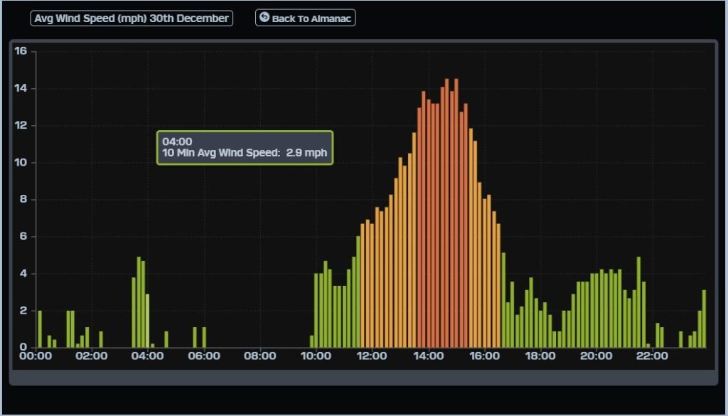
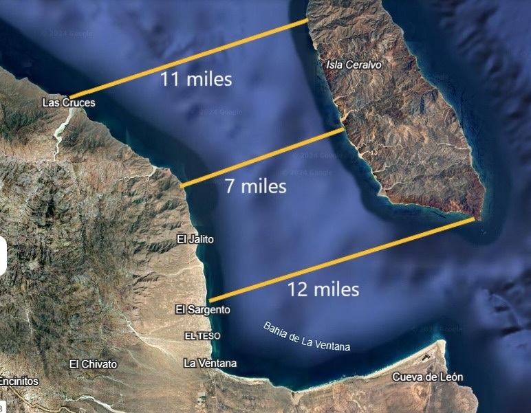
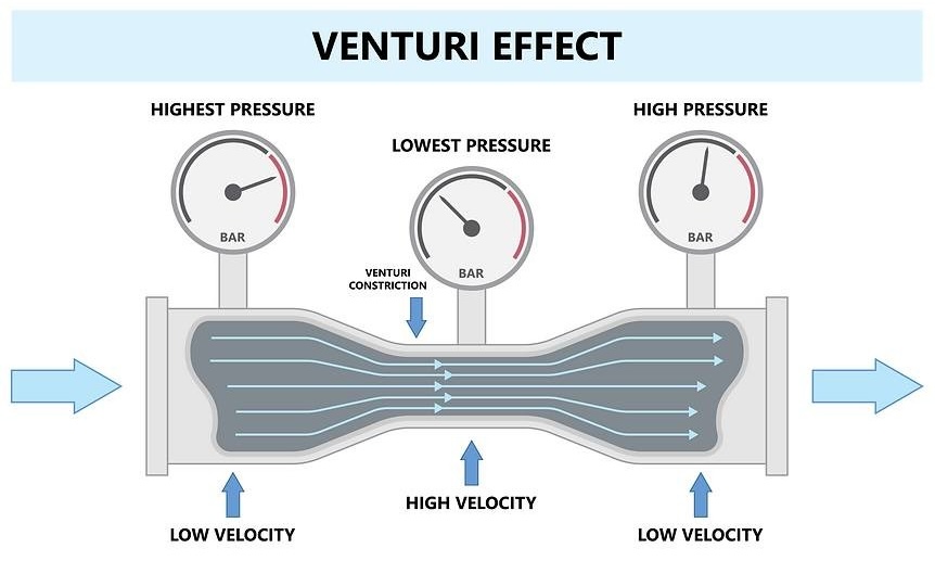
Nerd Note: I had a great opportunity yesterday to see the substantial variability in the wind speeds over the bay, as I was returning from a fishing trip from La Reina off the northern tip of Cerralvo around midday, then foiling along the northern beaches later in the afternoon. As our boat passed east of Punta Gorda, there was a sharp gradient of glassy seas to small whitecaps. This was likely where the Venturi effect was first accelerating the winds as the flow entered the constriction between Cerralvo and the Cacachilas Mountains to the west (see map). The gauge at the campground measured 12-14 mph sustained winds from around 1:30 until 3:30 (see graphic), while personal observations at Rasta Beach were closer to 16-18 mph, and an upwinder to Aguas Calientes was more like 18-20 mph. The maps shows how the constriction narrows to around 7 miles north of El Jalito, then widens again to around 12 miles at the south tip of Cerralvo. As the constriction widens, the Venturi effect weakens and winds decrease. On days where the background flow is very near the lower threshold for triggering our wind machine, I’ve noticed (confirmed by many others) that winds on the northern beaches are typically stronger, than to the south. It may be that when we have very marginal north flow, the Venturi effect is the dominant feature, while when the background flow is stronger, it reaches well into the southern bay and then is accelerated by our local thermal over the plains.


