¡Buenos dias! A couple of ASCAT passes last night measured 15 knot NNW winds over the Sea of Cortez just east of Cerralvo, and the overnight model forecasts show similar wind speeds lasting through today. Infrared satellite loops indicated only some thin, high clouds in our region early this morning, so we should see a significant thermal boost this afternoon. The surface high centered far to our north that is responsible for this latest surge of north flow will weaken a bit tomorrow, but models show ample north flow should continue and with sunny skies expected, we will likely see another windy afternoon. A very fast-moving storm system will race from Idaho on Friday night southeastward into the Texas panhandle by late Saturday, creating a weak trough of low pressure over the southwestern U.S. with our winds becoming light. Model forecasts are in good agreement that surface high pressure will quickly build back into the interior west of the U.S. on Sunday and push a fresh surge of north flow into the Sea of Cortez. Solid north flow will likely continue through Monday, then the global models begin to differ dramatically with regard to the weather pattern over our region as we move into the middle of next week (see nerd note below).
- Today…Mostly sunny. North wind 20-24 mph.
- Friday…Sunny. North wind 16-20 mph.
- Saturday…Sunny. Northeast wind 12-14 mph.
- Sunday…Sunny. North wind 16-20 mph.
- Monday…Sunny. North wind 16-20 mph.
- Tuesday…Sunny. Northeast wind 10-12 mph.
- Wednesday…Mostly sunny. East wind 8-10 mph.
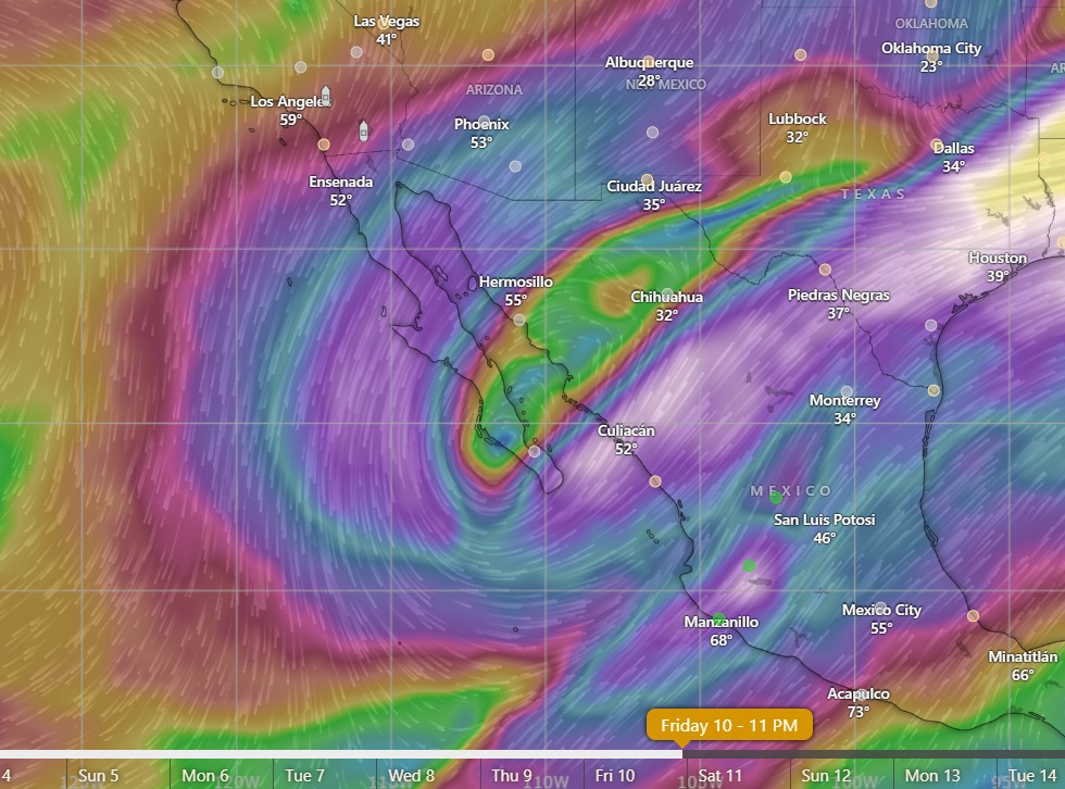
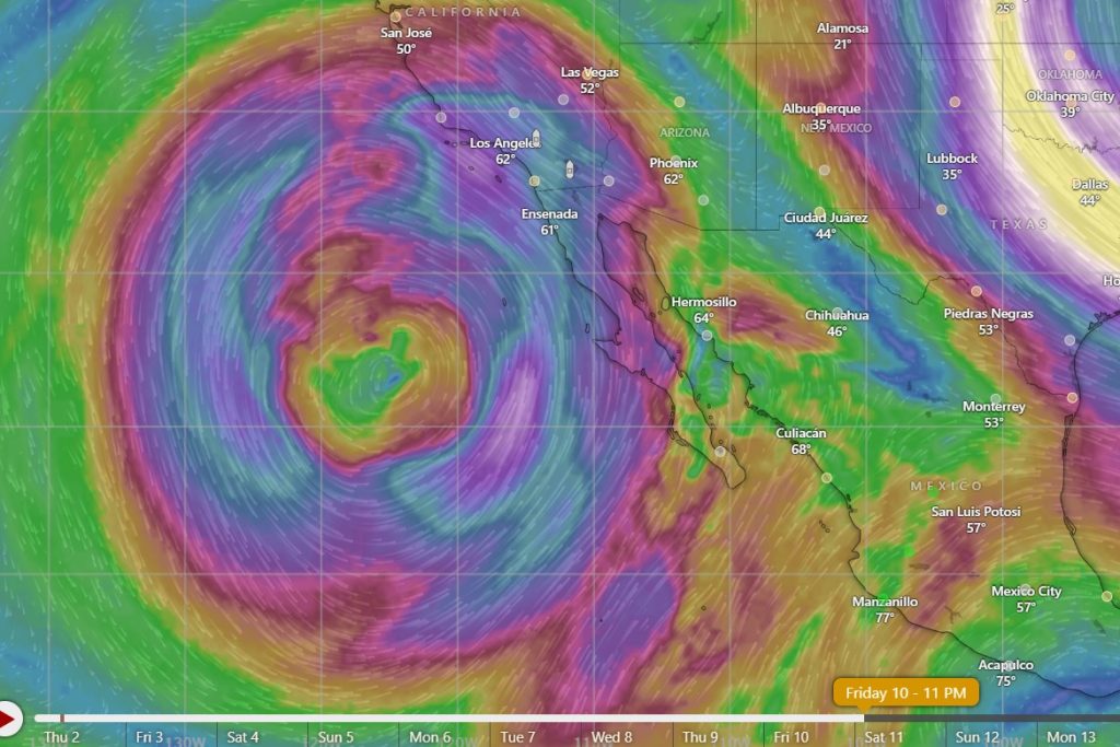
Nerd Note: The long-range global model forecasts show very different scenarios for our area by the middle of next week and moving into the following weekend. Both of the primary global models (GFS and ECMWF) show a strong trough forming in the middle and upper levels of the atmosphere, but the locations differ significantly (see graphics below). The GFS has the system near BCS, while the ECMWF has a stronger, closed low to our west. If the ECMWF solution verifies, significant moisture from the deep tropics would be drawn northeastward around the low to our west and bring showers and even thunderstorms to our area from Thursday into the following weekend. If the GFS is correct, we would see north flow continuing through much of next week with no rain. It’s interesting to note that an experimental artificial intelligence model run by the ECMWF shows the system forming to our west with significant rain here from Thursday into the following weekend.

